

BACKGROUND and DESIGN BRIEF
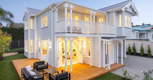
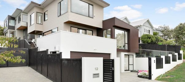
The background of this development, is that the old existing bungalow was in a state of disrepair, and needed a significant renovation. The larger section provided for 2 lots under the council zoning of the time. RESIDENTIAL – Mixed Housing Urban zone. ( Auckland Unitary Plan)
Obviously being in a good street Remuera made this development a viable proposition, for high-end new houses to be built.
The developers used SPACELINK SURVEYORS from start to finish.
Our experience and qualification as a Registered Professional Surveyor underpinned the ability to complete the whole project and provide continuity to the client.
The complete list of work done by SPACELINK SURVEYORS:
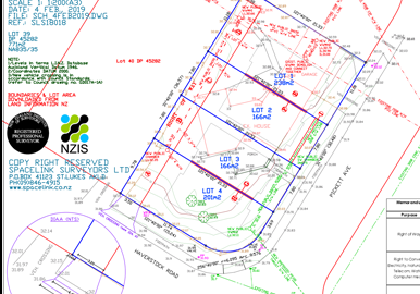
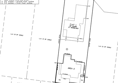
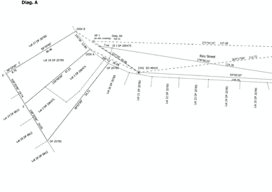
- Initial Topographical survey and Scheme Plan of proposed subdivision.
- Assessment of Effects report, including the neighbourhood and residential character assessment of the existing house, built prior to 1944 for demolition.
- Concept design of extension to the public stormwater reticulation in the street and across the road
Land-Use Consent and Subdivision Consent application compilation - Section 92 information and negotiations with Auckland Council planner and development engineer ( DE)
Setting out the 2 new dwellings and Siting Certification - Height to Boundary field checking and Certification for the Resource Consent compliance
- LINZ lodgement of the survey information for the 2-lot subdivision, including pegging all boundaries.
As-Built of new Public Drainage - Section 224c application to Auckland Council and liaison to have this issued by council
I have been working with David Crerar of SPACELINK SURVEYORS LTD on a few residential development projects for last few years. He is an experienced surveyor and cadastral specialist with many years of experience working with council and developers. His experience is helpful as he understands the ins and outs of the process and can save a lot of trouble and unnecessary expenses. He has a team of surveyors who can be on-site for topography and set out as soon as possible.